West Lithgow
| West Lithgow | |
|---|---|
| Location | CRNG, OCHOCO NF |
| Tree Count | 3 |
| Species | 3 apple |
| Varieties | 0 identified |
The West Lithgow orchard contains 3 documented heritage fruit trees.
History
West Lithgow is a small historic homestead orchard site located on the Crooked River National Grassland in Jefferson County, Oregon, approximately 0.5 miles northwest of the main Lithgow Springs orchard site.
Robert P. Johnson, Homesteader

The West Lithgow site was homesteaded by Robert P. ("Bob") Johnson, who was born in England in 1842 or 1843 and came to Central Oregon in the 1880s. He was granted the homestead's land patent in 1891. A caption to his portrait records that he homesteaded "in the 1880's-1890's at what is now the west abutment of Haystack Dam."
Johnson never married and had no children. He died in 1911, leaving the homestead to his brother Fredrick Johnson. The land was sold back to the federal government in 1937, part of the broad buy-back of struggling Central Oregon homesteads during the 1930s that consolidated abandoned claims across the Gray Butte and Haystack country into what became the Crooked River National Grassland.
Homestead Era
Johnson's orchard, like the nearby Lithgow Springs orchard, dates to the homesteading era of the late 1800s. The presence of Lombardy poplars near the orchard is characteristic of homestead sites throughout Central Oregon, where settlers planted these fast-growing trees for windbreaks and shade.
The site is located near an open wet meadow, which would have provided seasonal water for the orchard trees. This microhabitat, combined with the protection offered by surrounding vegetation, allowed fruit trees to survive in the otherwise harsh high desert environment.
Current Status
The 2024/2025 CRNG survey documented 3 surviving apple trees at the West Lithgow site:
| Field Tag | Condition | Notes |
|---|---|---|
| #124 | Fair (40% live crown) | 2 main stems forking ~18" above ground; reasonable health and vigor; plentiful water shoots; needs dead wood pruning |
| #125 | Poor (5% live crown) | 15' distant from #124; laying on side; watershoots present; heavy basal decay contributing to fall-down |
| #126 | Poor (1% live crown) | 15' distant from #125; also laying down with heavy basal decay; single live branch needing spring investigation |
A 4th dead apple tree was noted in the juniper grove beyond tree #126.
Site Characteristics
The West Lithgow orchard is distinguished by its association with:
- An open wet meadow providing seasonal moisture
- Lombardy poplars characteristic of homestead-era plantings
- Proximity to the larger Lithgow Springs complex
Historical Context
The West Lithgow site exemplifies the challenges faced by Central Oregon homesteaders. The current poor condition of trees #125 and #126 (both laying down with basal decay) reflects over a century of exposure to harsh weather, limited water, and encroaching juniper woodland without regular maintenance.
Despite their deteriorated condition, these trees represent important genetic resources and historical artifacts from the homesteading era. The presence of water shoots on even the most damaged trees indicates potential for preservation through grafting if unique varieties are present.
Sources: Robert P. Johnson homestead history and portrait from of Find a Grave, taken by the McCoin family; CRNG Fruit Orchard Survey 2024-2025
Photos
-
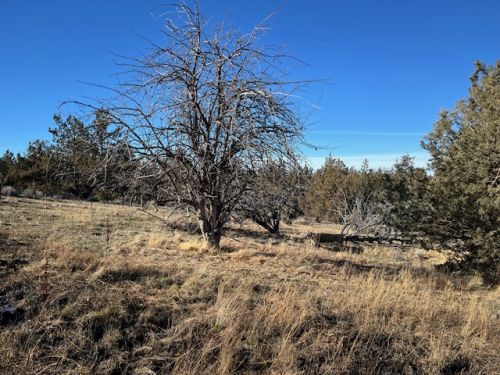 West Lithgow orchard
 -
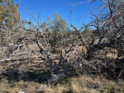
 Tree #124
 -
 Tree #125


Orchard Map
Trees
| Condition | Count |
|---|---|
| Good | 0 |
| Fair | 1 |
| Poor | 2 |
| Dead | 0 |
| Total | 3 |
Related Orchards
Lithgow Area Orchards
These orchards are located in the Lithgow Springs area of the Crooked River National Grassland.

